As a self-confessed addict to Google Maps, I would thoroughly recommend spending an hour or two immersing yourself in the fantastically absorbing world of EDINA Digimap Collections.
EDINA Digimap Collections are subscribed to by Aberystwyth University, allowing all University students and staff the opportunity to become registered Digimap users… and all for free! As a registered user, you will be able to access Historic Digimap, Geology Digimap and also the Ordnance Survey collection.
To register you will need to visit EDINA Digimap Collections or find Digimap through Primo (Follow the Databases A-Z link)
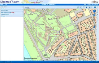
The Ordnance Survey (OS) collection brings together OS maps from the whole of the UK into one easy-to-navigate format. What really makes this resource a cut above Google Maps is the ability to interact with what’s on your screen, creating maps which are tailored to your needs
- annotate maps with labels, measurements, personalised shapes and symbols
- control which landmarks and features are visible
- accurately measure both area and distance
- view at 12 different zoom levels
- maps in all three collections can be saved into a personal My Maps store, to be edited, compared or printed at a later date
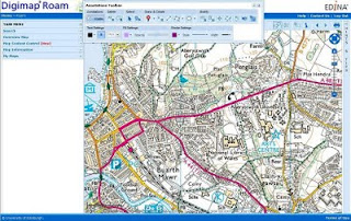
 Another map taken from the OS collection, this time including the tool bar which can be used to edit and customize what you see on your screen
  Historic Digimap is a real gem of a resource. Where the OS collection allows you to explore cities, towns and villages as they are today, Historic Digimap allows registered users to snoop back in time as far as 1840!
 But again, there’s far more to Historic Digimap than simply browsing.
As with the OS Collection, you have the ability to
- accurately measure both distance and area
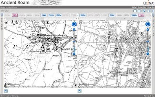
- compare up to 4 historic or contemporary maps in a single window
- use both historical and contemporary search tools so you can find a location by its contemporary postcode, place name, grid reference or historical parish and county name
- select and view maps from any decade (1840-present day)
This map shows the village of Giggleswick in North Yorkshire (childhood home of Countdown legend Richard Whiteley…) as it looked during the 1850s and again as it looked during the 1990s.

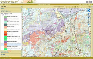
The University’s subscription also allows access to Geology Digimap, offering
- 1:625,000 solid and drift geology
- 1:250,000 solid geology and linear features
- 1:50,000 solid and drift geology, mass movement, artificial ground and seven separate linear feature layers
- the BGS Lexicon of named Rock Units
 Some further Hints and Tips…
 - EDINA Digimap Collections incorporates a simple data download facility so that the maps you are viewing can be downloaded to your computer for use in a Geographic Information System (GIS) or image processing software
- EDINA Digimap Collections provide online support for users, helping you to understand and make the most of your maps!
- If you are working off campus, remember to sign into Primo before accessing EDINA Digimap Collections to ensure you are authenticated
Academic Services
acastaff@aber.ac.uk
01970 621896
2 comments:
Can't wait to dive into this! Thanks for the tips. I'm an Aber Uni creative writing student and I want to map out the area I'm writing about, adding my own details, so this is perfect.
Hi Kat, we're glad you found it useful. That's a good idea for getting the sense of place and background for a creative work, it can be amazing if you need to jump through time and see how a place may have changed.
Post a Comment